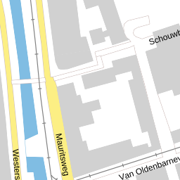
Mauritsplaats 44, Rotterdam
Busy, urban neighbourhood with significant safety challenges
Overall verdictFits best with City lifestyle, Expat / international
Excellent energy efficiency (class A), a convenient central city location with close access to schools (0.7 km), supermarkets (0.4 km) and doctors (0.8 km), modern utilities.
High crime rate (3,325 incidents per year): the main risks are bicycle theft, retail theft and car break-ins. Low safety (Leefbaarometer -0.25), high population density (10,865 inh/km²), significant noise pollution (49 dB), minimal greenery within a 500 m radius (6%).
- Energy class A with low annual consumption (131.6 kWh)
- Schools, shops and healthcare within walking distance
- 27 schools within a 2 km radius
- Residential property in active use and good condition
- A dynamic urban environment with many amenities
Is this address right for you?
Ideal for urban life: high density, everything within walking distance, a lively atmosphere and plenty of social activity. Despite the crime, the neighbourhood's energy is attractive.
Centrally located in Rotterdam, an international setting in a dense urban district, good access to services for newcomers. Practical vigilance against theft is needed, but the infrastructure for expats is excellent.
An average WOZ value (€376,000) in an area with 85% rental hints at rental-income potential. However, high crime, wear from intense use and low liveability indicators create uncertainty in long-term appreciation.
A compact space (72 m²), central location and energy efficiency suit starters. A lower price (in the context of 85% rental) can be advantageous, but serious crime and the pressure of a dense environment call for a personal assessment of tolerance.
Proximity to schools and services is ideal for families, but the high crime rate (especially bicycle theft), noise and lack of greenery call for constant vigilance.
A noise level of 49 dB, very high population density (10,865 inh/km²), intense traffic and constant urban bustle rule out peaceful living.
Questions for the agent
Facts about the home
Energy label & consumption
Energy class A: annual consumption 131.55 kWh with expected CO₂ emissions of 24.94 kg/year. The certificate is valid until 2035 based on a comprehensive assessment (NTA 8800:2024).
Housing & population in Cool
Cool has 6,625 residents at a density of 10,865 inh/km². 85% of homes are rented, 15% owner-occupied. The average WOZ of €376,000 reflects the average home value under urban conditions.
This neighbourhood on the scale of the Netherlands
National reference: CBS / Police, 2024.
Liveability Monitor 3.0 · 2024 measurement
The Leefbaarometer (2024) shows an overall index of 4.15 with weak safety scores (-0.25 indicates decline), social (-0.10) and housing conditions (-0.05). Physical environment (-0.02) and traffic (-0.05) are also negative.
Registered crimes · 2025
In Cool, 3,325 crimes were recorded in 2025. High numbers of bicycle theft (390), car break-ins/thefts (207), retail theft (385) and other property crimes (604) form the main threat.
Air, noise, greenery & climate
Noise load 49 dB (a lively urban environment), an acute shortage of greenery (6% trees and 17% green-blue zones within 500 m), heat-island effect +2.4°C, moderate air quality (NO₂: 23.3 μg/m³, PM2.5: 9.7 μg/m³).
Primary schools within 2 km
Asking price versus the neighbourhood
The average WOZ value in the neighbourhood is €376,000 per property. No asking price is available for this specific property.
What does this cost per month?
Viewing checklist
Sources & resolution
Per-address data comes only from PDOK (BAG + Location server) and EP-Online. All other figures apply to the neighbourhood or municipality. That's why we say “in this neighbourhood”, never “this house”. Addresses are linked by PDOK to the nearest existing address.