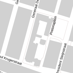
Pretoriaplein 2, Haarlem
Stable, compact urban neighbourhood — caution recommended
Overall verdictFits best with City lifestyle, Family with children, Starter
Advantageous location: schools and shops within walking distance (0.6 km), 22 schools within a 3 km radius. Energy efficiency: class B with low annual consumption (176 kWh). Environmental balance: 33% green/blue zones, noise level 51 dB (acceptable for the city).
Bicycle theft (19 cases) is the most frequent crime. Minor thefts and traffic accidents are spread across the neighbourhood. A total of 98 incidents per year indicates moderate risk in a typical urban context. A slight rise in fraud (12 horizontal-type cases).
- Compact neighbourhood: everything needed within 0.6 km (school, doctor, shops)
- Energy class B and low consumption (176 kWh/year) for a house built in 1906
- 19 primary schools within a 2 km radius, a variety of denominations
- Acceptable noise level (51 dB Lden) for an urban area
- 60% of homes owner-occupied, a stable market
Is this address right for you?
Central location, supermarket 0.6 km, doctor 0.7 km. Many amenities within walking distance. Ideal for young professionals.
22 schools within 3 km, nearest at 0.6 km. Good, safe routes. The density and bicycle theft do call for supervision.
Compact (84 m²); energy class B reduces costs. Plenty of amenities and schools. WOZ €415k within the city is competitive.
A diverse population and schools of different denominations. But low social-integration scores (-0.067) call for actively seeking community.
A noise level of 51 dB is acceptable, but the neighbourhood remains urban. Low scores for social cohesion (-0.067) and physical condition (-0.031) point to tension.
Average WOZ €415k and 60% owner-occupied indicate stability. However, the age of the house (1906) and possible hidden costs call for a conservative assessment.
Questions for the agent
Facts about the home
Energy label & consumption
Class B, 176 kWh/year, 35.79 kg CO₂/year. High efficiency for a building from 1906, likely after modernisation. Certificate valid until 2035.
Housing & population in Generaalsbuurt
2,040 residents, 19,503 inh/km² (high density). 540 one-person households out of 1,100 (49%). 60% owners, 40% renters — a mixed population.
This neighbourhood on the scale of the Netherlands
National reference: CBS / Police, 2024.
Liveability Monitor 3.0 · 2024 measurement
Liveability index 4.07 (above average). Social cohesion low (-0.067), physical condition weak (-0.031), safety moderate (onv -0.109).
Registered crimes · 2025
Bicycle theft (19/year) is the main risk. Traffic accidents and minor thefts (8 and 10) are evenly spread. Fraud (12, horizontal type) mostly plays out in surrounding areas.
Air, noise, greenery & climate
33% green/blue within 500 m, 9% trees. Noise 51 dB Lden — the upper edge of comfort. Hazardous substances within 1 km; no flood risk (0%).
Primary schools within 2 km
Asking price versus the neighbourhood
Average WOZ in the neighbourhood €415,000. No current asking price available.
What does this cost per month?
Viewing checklist
Sources & resolution
Per-address data comes only from PDOK (BAG + Location server) and EP-Online. All other figures apply to the neighbourhood or municipality. That's why we say “in this neighbourhood”, never “this house”. Addresses are linked by PDOK to the nearest existing address.